
Trails & Wide-Open Spaces
Walking & Hiking
Follow riverfront pathways, explore open ranchland, hike forest trails, and climb toward some of Central Wyoming’s most memorable views.
Walking & Hiking for Every Skill Level
Converse County and the surrounding area offer walking and hiking experiences for nearly every skill level.
Enjoy an easy walk along the North Platte River, explore multi-use trails through open Wyoming landscapes, or head into the Medicine Bow National Forest for mountain scenery, wildlife, wildflowers, and challenging climbs.
Choose Your Adventure
From paved community pathways to mountain trailheads, there are plenty of ways to explore Converse County on foot, by bike, or on horseback.
Douglas Pathway: Bike & Walk Trail
Douglas offers approximately 3.5 miles of riverfront trail with views of the North Platte River along much of the route. The pathway connects with several city parks and winds through sagebrush, open areas, and small shaded glens. It is a popular year-round place to walk, jog, or ride a bike.
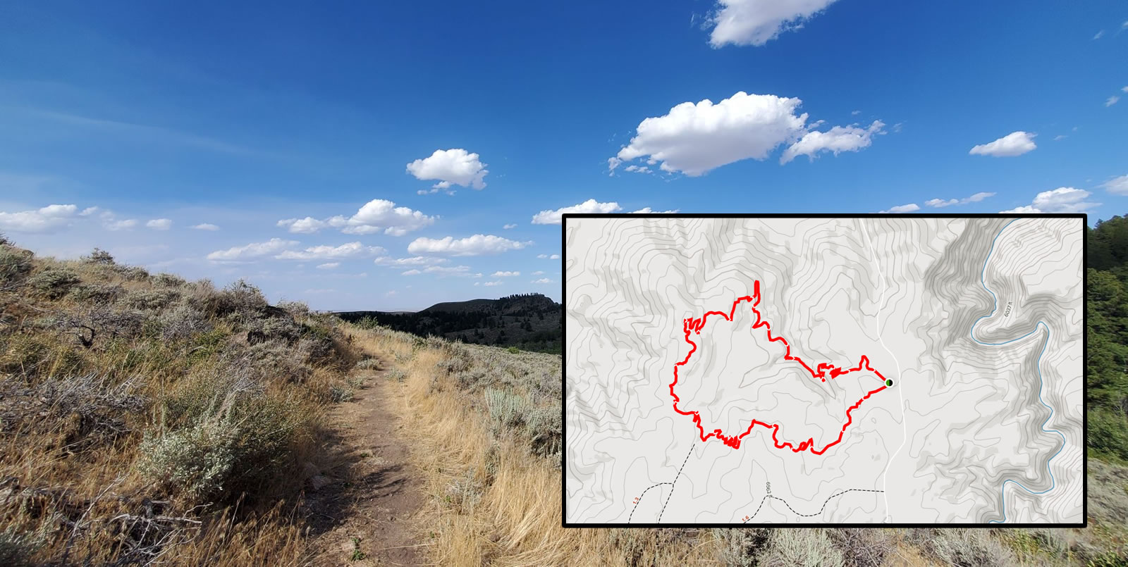
Duncan Ranch Trail
Duncan Ranch is a scenic outdoor space featuring approximately 5.1-mile and 3.5-mile loop options. The area is well suited for hiking, mountain biking, horseback riding, birding, and wildlife watching. Additional state and county lands nearby provide even more room to explore.
|
More Than 45 Miles of Trails Glendo State ParkGlendo State Park and the surrounding reservoir area are located just beyond the Converse County line and offer more than 45 miles of non-motorized trails. The four primary trailheads are Dam Overlook, Two Moon, Wetlands, and Sandy Beach. Trails are generally open throughout the year. Day-use fees apply. Review current Wyoming State Parks permit and fee information before visiting. |
Mountains, Forests & Wildlife Medicine Bow National ForestSouth of Douglas lies the expansive Medicine Bow National Forest. The forest provides opportunities for hiking, camping, mountain biking, stargazing, wildlife watching, scenic driving, photography, and other outdoor adventures. |
Family-Friendly Mountain Trail
Sunset Ridge Trail is a relatively easy two-mile loop in the Medicine Bow National Forest. The trail is especially enjoyable from June through November and offers impressive views of Laramie Peak and the surrounding mountains.
The trail is a good option for families, photographers, and hikers looking for a shorter outing. Leashed dogs are welcome, and shaded areas provide comfortable places to stop for a picnic.
Getting to Sunset RidgeTake Exit 140 from Interstate 25. Follow Wyoming Highway 94 south toward Esterbrook and Harris Road for approximately 30 miles. Continue onto Esterbrook Road for approximately 11 miles. Turn left onto 3rd Street/Harris Park Road/Forest Service Road 633. The trailhead will be on the left. Road conditions: The route includes gravel roads, but it is generally accessible to most passenger vehicles during suitable weather conditions. |
ATV & ORV AccessAn OHV trailhead is located farther along Forest Service Road 633. A valid Wyoming State ORV permit is required when operating an off-road vehicle on designated Forest Service routes. Permits may be available through the Converse County Treasurer’s Office or Ace Hardware in Douglas. |
Curtis Gulch Trail
Curtis Gulch Trail is located within La Bonte Canyon in the Laramie Peak area, approximately 35 miles southwest of Douglas. The lightly traveled, four-mile out-and-back trail features wildflowers, three creek crossings, canyon views, abundant wildlife, and a mix of aspen and conifer trees.
The trail is generally best from June through September. Leashed dogs are welcome. The canyon floor sits at approximately 6,000 feet in elevation, and the surrounding granite formations provide opportunities for climbing and photography.
Getting there: Take State Highway 91 west and south from Douglas for approximately 20 miles. Continue south on Converse County Road 16 for approximately 14 miles, then travel northeast on Forest Road 658 for one mile. Curtis Gulch Trailhead is approximately 50 yards west of Curtis Gulch Campground on the north side of the road.
A Challenging Mountain Adventure
At 10,272 feet, Laramie Peak is the highest point in the Laramie Range. The hike is considered moderate to difficult, with more than 2,700 feet of elevation gain and a round-trip distance of nearly 10 miles.
Wildlife is abundant, leashed dogs are welcome, and snow may remain at higher elevations. Hikers should prepare for changing mountain weather and check current conditions before beginning the climb.
Getting to Laramie Peak
From Douglas, travel south on Wyoming Highway 94 for approximately 17 miles. Continue onto Esterbrook Road/County Road 5 for approximately 11 miles to Esterbrook. Turn right and continue southwest on County Road 5 for another 15 miles. Turn left onto Forest Road 671 for two miles, then turn left onto Forest Road 661 and continue approximately one mile to the campground and trailhead area.
Check ConditionsMountain roads and trails may be affected by snow, mud, storms, wildfire restrictions, or seasonal closures. |
Come PreparedCarry water, sun protection, layers, navigation tools, appropriate footwear, and enough supplies for your planned route. |
Respect the LandStay on designated routes, pack out all trash, keep pets under control, and give wildlife plenty of space. |
Choose an easy riverfront pathway, explore open Wyoming terrain, or head into the mountains for a trail adventure you will remember.